
Papua New Guinea has announced the establishment of the Western Manus Marine Protected Area, a 200,000-square-kilometer no-take zone in the Bismarck Sea, aimed at enhancing regional conservation efforts.
In a significant expansion of conservation efforts in the Pacific Ocean, Papua New Guinea has unveiled plans to establish the Western Manus Marine Protected Area (MPA). This ambitious initiative designates a 200,000-square-kilometer “no-take” zone in the Bismarck Sea, which will completely prohibit industrial fishing and all other extractive human activities within its boundaries. Announced at the inaugural Melanesian Ocean Summit in Port Moresby, the reserve is roughly equivalent in size to the United Kingdom and will serve as a foundational anchor for the newly formed Melanesian Ocean Corridor of Reserves. This collaborative network aims to connect protected areas across Papua New Guinea, Fiji, and Vanuatu.
Government officials emphasize that while the zone encompasses active commercial fishing grounds, extensive ecological data suggests that the closure will ultimately stabilize regional fish stocks through biological spillover effects, without harming the national economy.
The establishment of the Western Manus MPA was formally announced before an audience of over 500 regional leaders, international scientists, and policy delegates at the Melanesian Ocean Summit. This new sanctuary will serve as the western anchor for the Melanesian Ocean Corridor of Reserves (MOCOR), a coordinated network of national and jointly managed marine protected areas aimed at creating contiguous migratory pathways and ecological safe havens across the Melanesian archipelago.
Located within the Coral Triangle, a region recognized as the global epicenter of marine biodiversity, Papua New Guinea’s exclusive economic zone is home to an extraordinary array of marine life. Baseline surveys have documented more than 700 distinct reef fish taxa and over 300 species of hard coral within its waters.
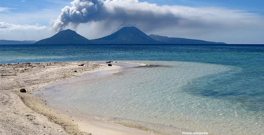
The Western Manus region is characterized by complex underwater topography, featuring steep mountains, deep-sea ridges, and oceanic canyons. Oceanographers describe this terrain as a “marine highway” that connects shallow, sunlit reef systems to unexplored abyssal environments thousands of meters below.
Implementing a strict “no-take” policy across such a vast territory introduces complex economic variables for a developing nation that relies on its marine resources. The newly designated Western Manus MPA covers an area that currently accounts for approximately 6.7% of Papua New Guinea’s total industrial fishing yield and 10% of its highly lucrative industrial tuna fishing operations.
Despite the immediate withdrawal of these waters from commercial exploitation, government economists and fisheries officials express confidence that the long-term economic impacts will be net-positive. This assessment is supported by empirical data gathered from comparable large-scale marine protected areas across the Pacific and Indian Oceans.
Research indicates that well-enforced, large-scale marine sanctuaries generate a “spillover effect,” where fish populations within the protected zone multiply rapidly and migrate into adjacent, legally fishable waters. On average, commercial tuna catch rates have been observed to increase by 12% to 18% along the outer boundaries of established marine reserves, effectively replenishing adjacent commercial fisheries.
“Papua New Guinea is one of the most biodiverse places on the planet,” stated Jelta Wong, Minister of the country’s National Fisheries Authority. He emphasized the balance between conservation and national interest, stating, “Establishing the Western Manus Marine Protected Area will allow us to preserve and protect our ecological legacy while ensuring that our ocean continues to provide food and a source of income.”
This policy shift aligns with international conservation benchmarks, particularly the global “30 by 30” initiative, which challenges nations to designate 30% of their land and sea territories as protected areas by 2030.
“We take our commitment to protect 30% of our waters by 2030 very seriously,” said Yvonne Tio, Executive Manager at the Conservation and Environment Protection Authority (CEPA). “This new MPA brings us one large step closer to that goal, ensuring environmental sustainability for present and future generations.” Tio emphasized that local communities remained central to the planning process, stating, “Our rigorous process for researching and designating which areas to prioritize for protection always puts communities first.”
The boundaries of the Western Manus MPA were established through an intensive, data-driven scientific campaign. In 2024, National Geographic Pristine Seas launched a comprehensive three-month research expedition in partnership with PNG’s CEPA and the Wildlife Conservation Society (WCS). Utilizing advanced deep-sea submersibles, drop cameras, and satellite tracking tags, the research team documented both the ecological vitality and vulnerabilities of the remote Bismarck Sea.
The expedition gathered critical data on pelagic and migratory species. To determine the optimal geographic scope of the reserve, scientists mapped the movements of endangered grey reef sharks using acoustic and satellite telemetry, observing how these predators moved between shallow reefs and deep-water drop-offs.
However, recognizing that multi-species ecosystems require broader protections, the final boundary was extended beyond the immediate habitat of the sharks to encompass the foraging ranges of wide-ranging pelagic seabirds, which often travel more than 200 nautical miles from their nesting sites to gather food.
The scientific team documented thriving coral communities in the Western Islands, which have managed to resist severe bleaching events affecting other tropical reef systems globally. Yet, they also recorded warning signs of anthropogenic pressure, including notably low shark populations across several surveyed sites, indicating ongoing targeted longline fishing pressure.
Additionally, the team’s deep-sea cameras captured footage of unique abyssal organisms, including the colossal yokozuna slickhead, a deep-sea apex predator never previously recorded in Papua New Guinea’s territorial waters.
“At a time when coral reefs are in crisis, it’s exciting to see the Western Islands still shimmering with healthy corals and schools of fish,” noted Lindsay Young, Vice President of Research at Pristine Seas. She emphasized the interconnectedness of the ecosystem, stating, “This is not just a beautiful place; it’s a highly connected system where shallow reefs, deep-sea habitats, and open ocean waters are linked, supporting species that move across them.”
The resulting sanctuary is designed to protect a vast array of vulnerable marine megafauna, including scalloped hammerhead sharks, silky sharks, spinner dolphins, bottlenose dolphins, and Cuvier’s beaked whales. The area also contains critical feeding corridors for pods of killer whales that migrate through the Bismarck Sea on a seasonal basis.
For the indigenous populations of Manus Province and surrounding islands, the establishment of the MPA represents an institutional validation of traditional conservation practices. For centuries, Melanesian coastal communities have utilized customary marine tenure systems, known locally as tambu zones, to temporarily close areas to fishing and allow marine populations to recover.
Powes Parkop, Governor of the National Capital District, framed the announcement as a historic milestone that bridges ancestral tradition with modern international law. “Our ancestors have always lived in harmony with the sea, but today, we are writing a new chapter for our children,” Parkop stated, emphasizing that environmental stewardship is intertwined with cultural preservation.
Following the successful conclusion of the Melanesian Ocean Summit, the focus shifts to the statutory implementation of the MPA. The government of Papua New Guinea is set to initiate the formal legislative process required to grant the Western Manus MPA permanent legal designation. This phase will involve finalizing specific legal coordinates, establishing monitoring protocols, and allocating national budget resources for maritime enforcement.
Government compliance vessels, supported by satellite surveillance data and international conservation partners, will patrol the perimeter to deter illegal, unreported, and unregulated fishing vessels that frequently target the rich waters of the Coral Triangle. This comprehensive approach aims to ensure the long-term health of the ocean and the communities that depend on it, according to Source Name.