
A recent study reveals that up to 132 million more people are at risk from rising sea levels than previously estimated, highlighting significant flaws in historical ocean height measurements.
A groundbreaking study published in the journal Nature indicates that up to 132 million more people than previously calculated reside in zones threatened by rising sea levels. This discrepancy arises from a “methodological blind spot” in historical satellite modeling that has consistently undervalued current ocean heights by approximately 10 inches.
The scientific community is facing a sobering recalibration of global climate risk. For decades, projections that have shaped international policy and maritime defense relied on a baseline that may now be fundamentally flawed. New evidence suggests that the physical starting point of the world’s oceans is significantly higher than models assumed, meaning the encroachment of saltwater into human settlements is occurring on a much more aggressive timeline than previously communicated to world leaders.
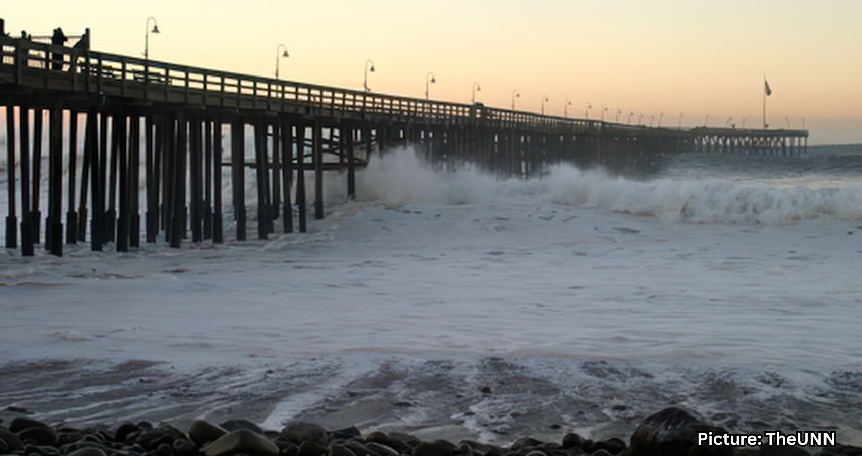
As the planet warms, the mechanics of sea-level rise are well-documented: melting glaciers and polar ice caps discharge freshwater into ocean basins, while thermal expansion—the tendency of water to occupy more space as it heats—compounds the volume. However, the true scale of the threat has been obscured by how we measure the “zero point” of the sea. According to a study led by Philip Minderhoud, an associate professor at Wageningen University in the Netherlands, the vast majority of existing research uses ocean heights that are roughly 10 inches lower than their actual current levels.
This 10-inch gap is not merely a rounding error; it represents a catastrophic oversight in topographical mapping. When this missing height is integrated into future projections, the number of people in the path of a three-foot sea-level rise—a scenario widely expected by the middle of the next century—jumps by 132 million. This represents a 68% increase in the human toll compared to previous global estimates.
The error traces back to the reliance on geoid models, which are mathematical simulations of the Earth’s surface based on gravity and rotation. While these models provide a theoretical “level” for a calm ocean, they often fail to account for the dynamic reality of the seas. Factors such as persistent trade winds, complex ocean currents, and tidal cycles create a “piling up” of water in certain regions.
Minderhoud’s realization began not in a laboratory, but in the muddy stretches of Vietnam’s Mekong Delta. While conducting field research, he noted that the water was consistently higher than what the global data sets suggested. Upon reviewing 385 separate sea-level studies conducted between 2009 and 2025, Minderhoud and his colleagues discovered that 90% of them were working from an artificially low baseline.
“In a way, a geoid gives you the surface of the ocean in a calm situation, without disturbances,” Minderhoud explained. By ignoring the “disturbances” of a living, moving ocean, scientists inadvertently drew a map where dry land appeared safer than it actually was. The underestimate is most acute in Southeast Asia and the Indo-Pacific, where actual sea levels are currently more than three feet higher than standard research assumes.
The economic implications of this data shift are staggering. Coastal real estate, infrastructure, and agricultural hubs—particularly in developing nations—are facing an existential threat that is already “priced in” to the environment but not yet fully accounted for in global financial risk assessments. For low-lying island nations, these findings provide a powerful, if grim, new tool for international climate negotiations.
At summits like COP, vulnerable nations have long argued for “Loss and Damage” funding, seeking compensation from wealthier, high-emitting countries for the destruction already underway. A 68% increase in the projected human impact strengthens the moral and economic argument for massive transfers of wealth to fund climate adaptation.
However, the report also highlights a divide between global modeling and local reality. Bob Kopp, a professor of Earth and planetary sciences at Rutgers University, notes that while the global “screening” might have been off, local engineers are rarely fooled by a computer model when the water is at their boots. “If you’re actually doing adaptation planning, presumably any responsible planner is going to know where the water actually is,” Kopp said. He emphasized that local municipalities typically use direct measurements and “tide gauges” rather than global gravitational models to build their sea walls and drainage systems.
Even if local planners are aware of their immediate risks, the global data remains vital for long-term strategy. The study suggests that up to 37% more land area will be subject to permanent inundation or frequent “sunny day” flooding. This type of flooding occurs during high tides even in the absence of a storm, turning streets into canals and corroding the foundations of urban centers.
On the U.S. East Coast, where land is simultaneously sinking due to geological processes, the combined effect of rising water and subsiding soil is accelerating the timeline for “managed retreat”—the controversial policy of moving entire communities inland.
The urgency now shifts to how quickly global leaders can narrow the gap between these new scientific realities and current policy. With millions more lives in the balance, the margin for error has evaporated. The “methodological blind spot” has been illuminated; the question remains whether the world will find the political will to act before the tide officially arrives, according to Nature.